
Geotechnical support
Drone surveys provide efficient, high-resolution data for assessing terrain, soil stability, and potential hazards. By capturing detailed aerial imagery, drones help quickly and accurately analyse sites, improving decision-making and reducing survey time and planning stabilisation measures more effectively, enhancing safety and reducing cost.
Planning
With remote sensing providing high-resolution aerial imagery to assess terrain, soil conditions, and slope stability. By capturing detailed topographic data, drones help engineers identify potential hazards, evaluate risk areas, and monitor existing conditions. This technology enables more accurate site analysis, supports effective planning for stabilization measures, and ultimately improves the efficiency and safety of geotechnical projects.
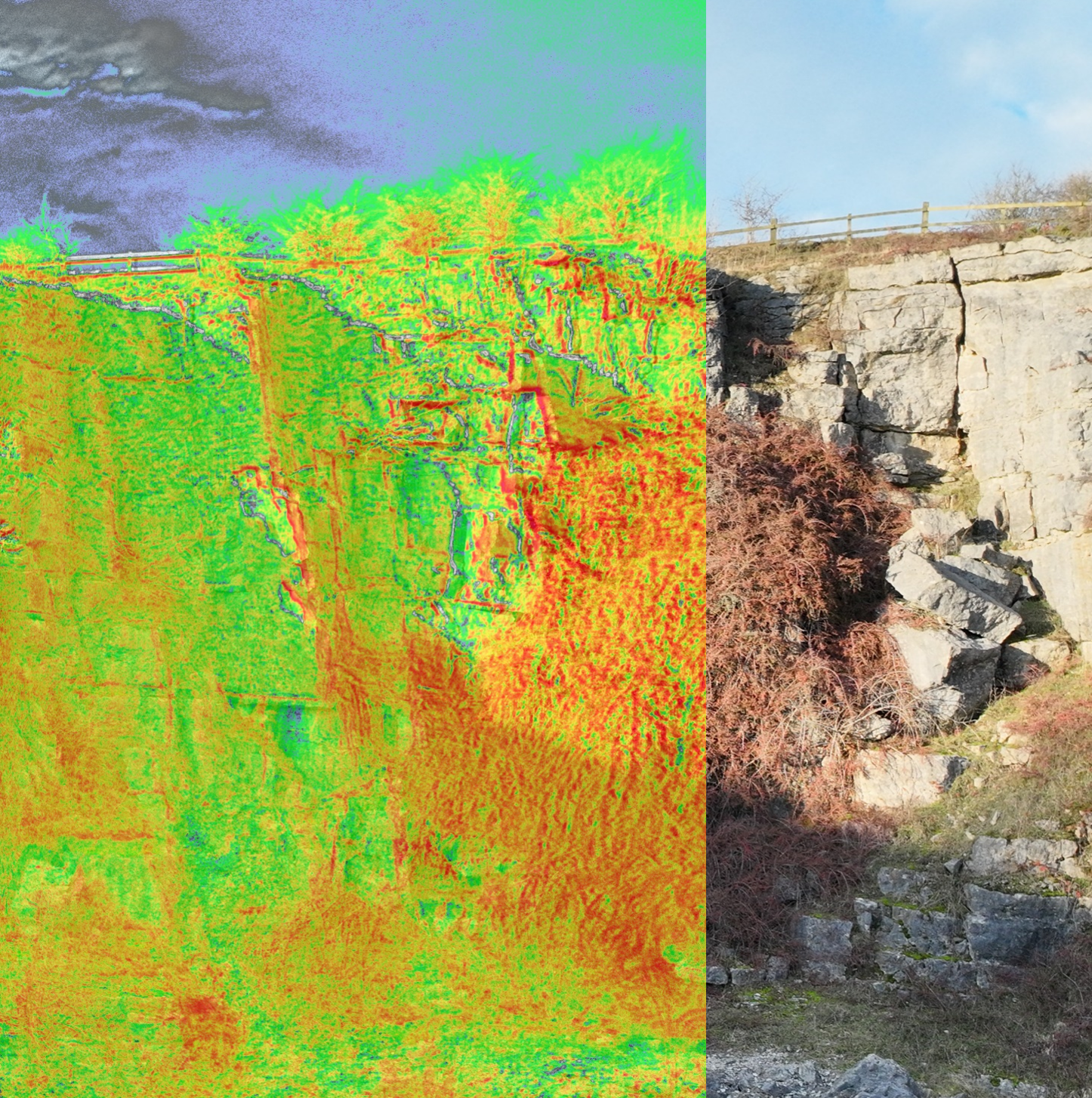
Vegetation identification
Multispectral imaging is highly effective for vegetation identification across all environments, capturing data across multiple wavelengths to assess plant health, stress, and distribution. This technology helps identify vegetation types, monitor growth patterns, and detect areas of erosion or instability, providing valuable insights for planning stabilisation measures. By accurately mapping vegetation on slopes, multispectral drones support informed decision-making in erosion control, habitat preservation, and overall slope management strategies.
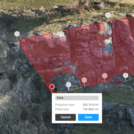
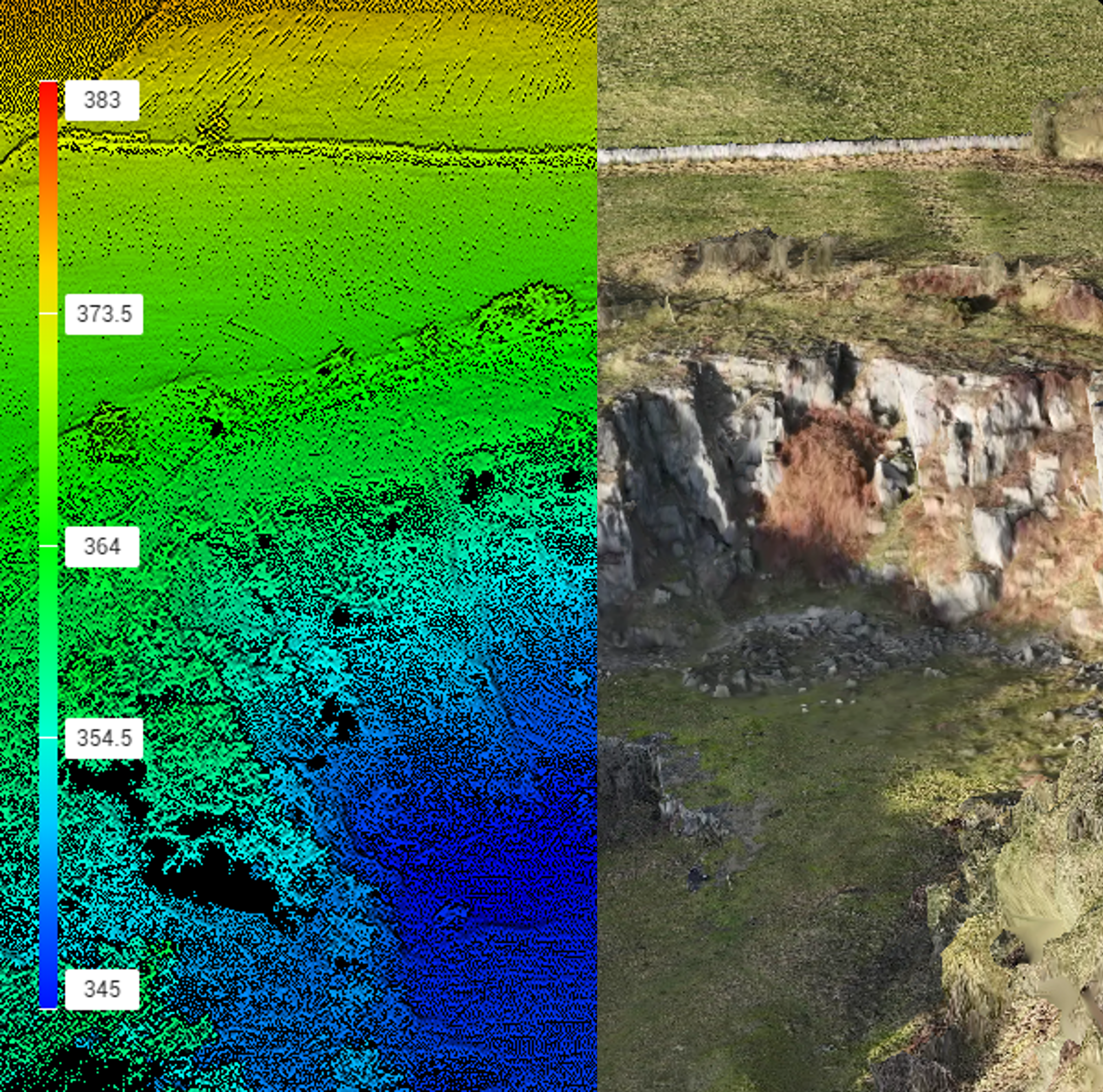
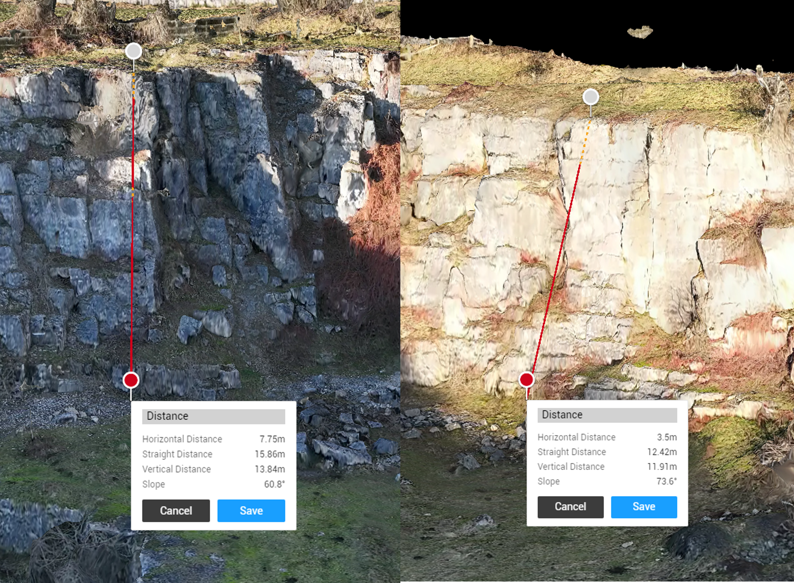
Assessing
Using 3D and topographic data assists in planning geotechnical projects by providing detailed, accurate visualisations of terrain and subsurface conditions. This data enables engineers to assess slope stability, identify potential hazards, and design effective stabilisation or foundation solutions. By integrating 3D models and topographic maps, geotechnical teams can optimise site planning, reduce risks, and improve the overall efficiency of construction and stabilisation projects.
