
ecological / environmental
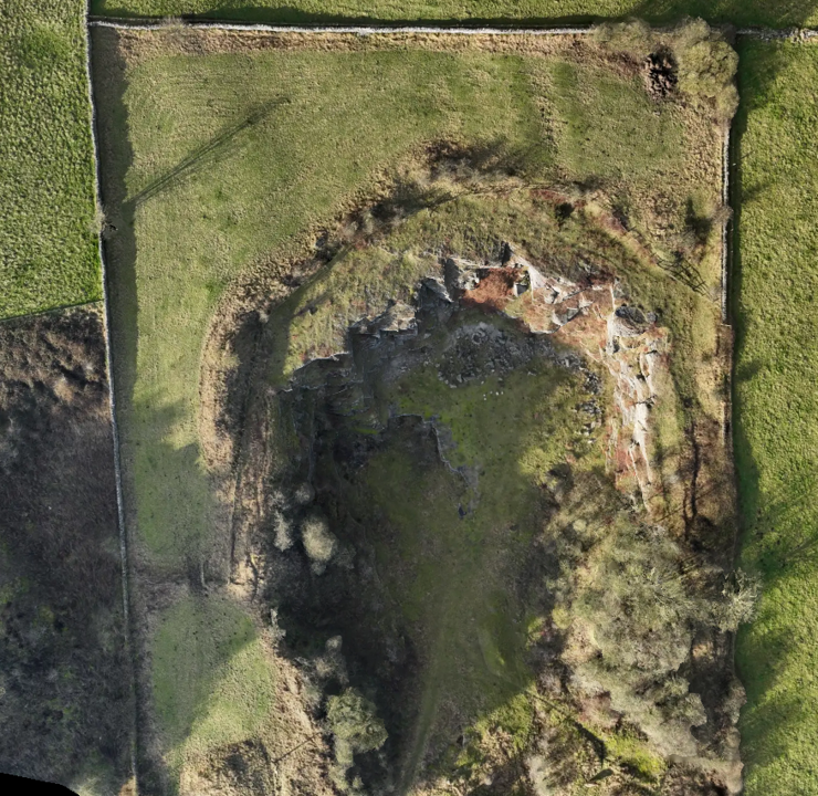
Drone surveying, combined with multispectral imaging and GIS, provides ecologists with precise, real-time data to monitor ecosystems, assess vegetation health, and support biodiversity and conservation efforts.
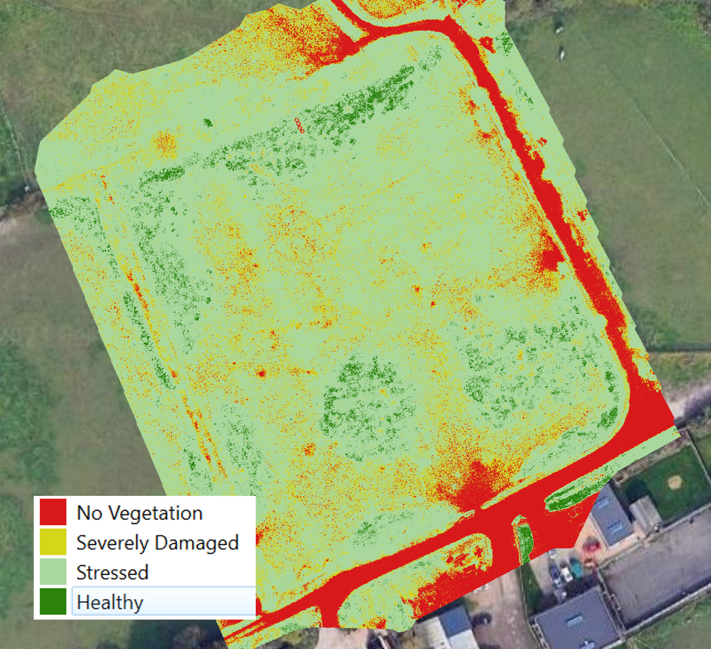
VEGETATION health
Using aerial multispectral surveying, detailed insights into plant health, vegetation stress, and environmental conditions by capturing data across different light wavelengths. This technology assists in monitoring ecosystems, assessing biodiversity, and detecting changes in habitats, enabling more informed decision-making for conservation, land management, and environmental protection.
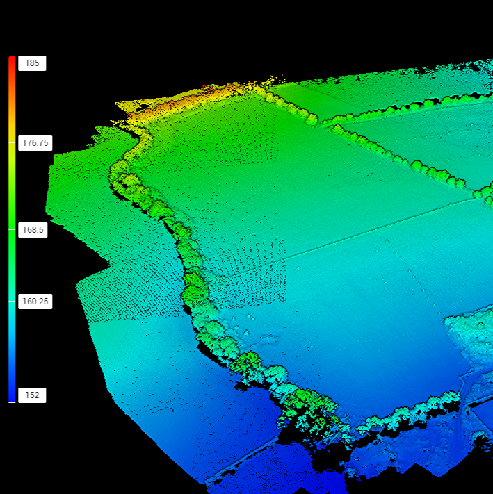
Measurements
Using aerial surveying measurements allows for the efficient collection of high-resolution data on ecosystems, vegetation, and wildlife habitats, providing critical insights into environmental health, biodiversity, and habitat changes without disrupting natural settings.
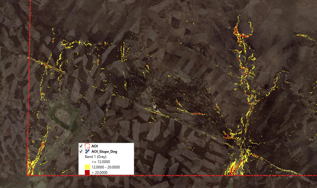
Analysis
Using geospatial processing on collected or acquired data to visualise and understand ecosystems, track biodiversity, assess environmental changes, and support conservation planning with greater accuracy and efficiency.
