
Agricultural
Aerial surveying using multispectral cameras to assist in crop health, land management and identification of applicable government incentives, grants and schemes and their affects on land utilisation.
Crop health
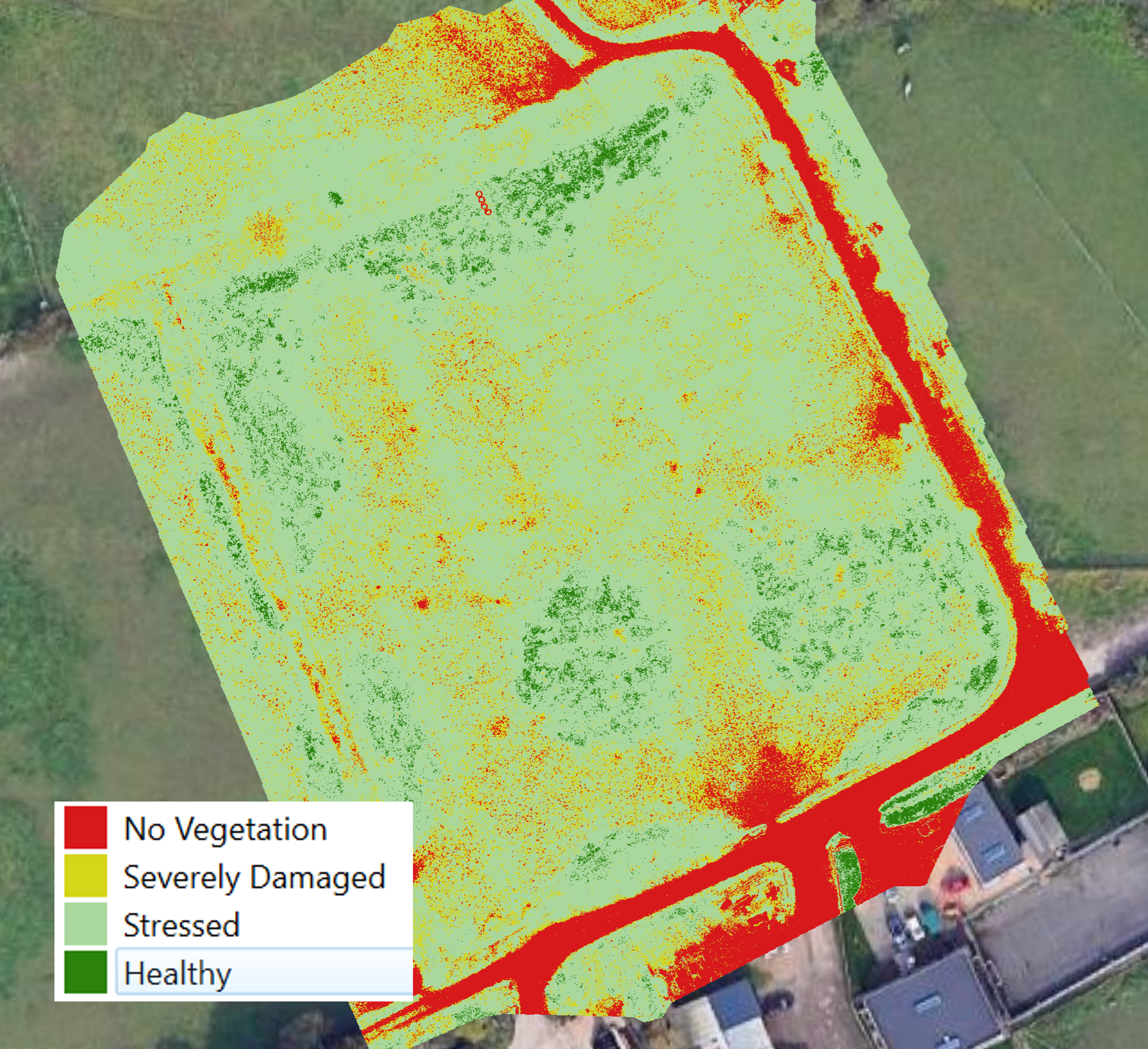
Utilising multispectral remote imaging, we are able to view and understand the health of vegetation, highlighting areas of stress and concern.
Measurements
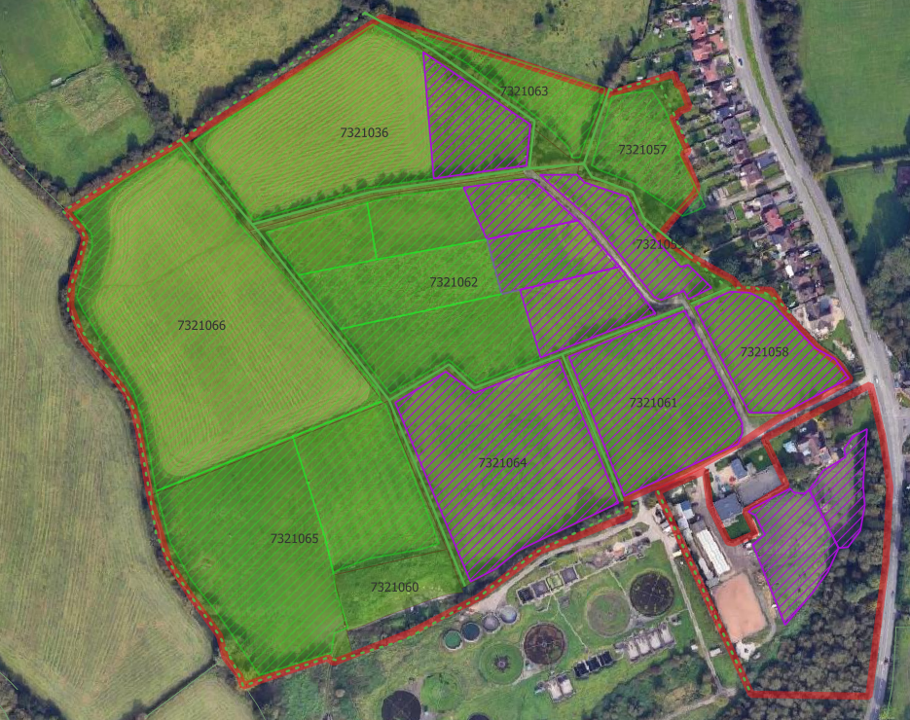
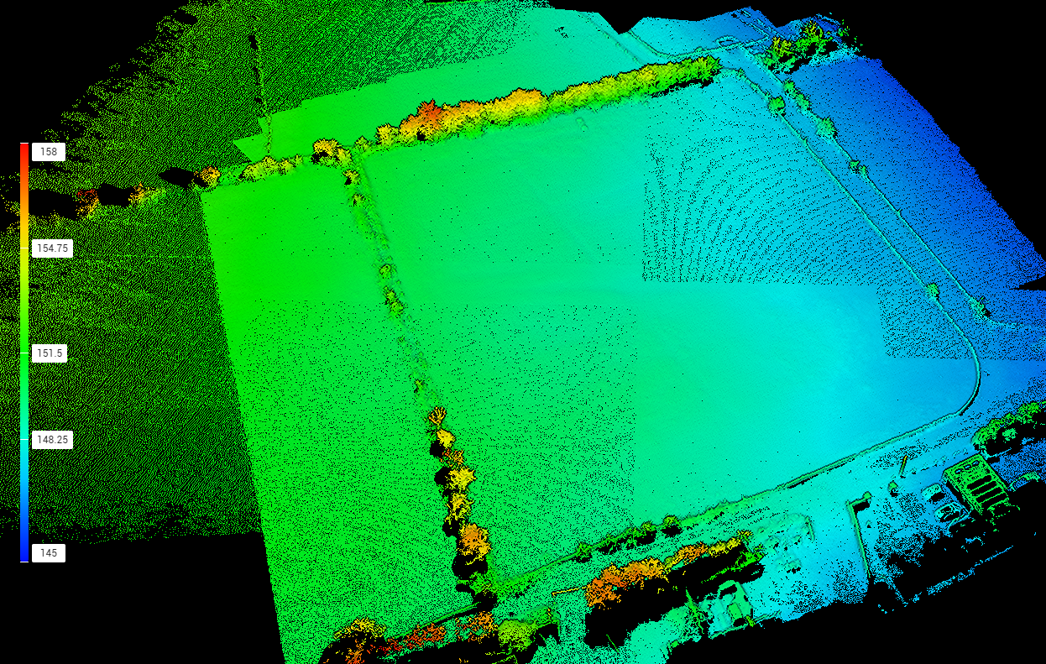
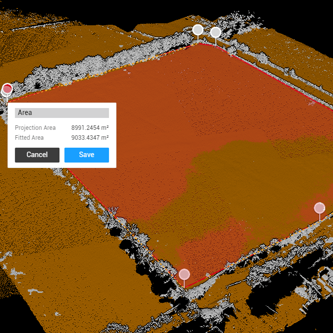
Mapping your land identifying differing land use, including height and area measurements. Outputs in applicable formats for agencies such as RPA and DEFRA.
schemes & Incentives
Detailed information to help inform utilisation of government schemes, grants and incentives, highlighting effects on land for the scheme to be taken on.
